Languedoc Maps
The following are maps of the Languedoc and related areas..
Where there is an accompanying button, you can click on it to go the Amazon site, or in some cases other third party sites, to see more information, read reviews and purchase copies of the book in question.
|
Amazon Links Below |

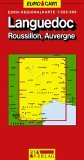
Michelin Languedoc Roussillon
by Michelin

Road map of Languedoc and Roussillon, covering the main and secondary road networks across the region.
Updated annually
Scale: 1/200,000 - 1cm=2km
Legend in French & English.

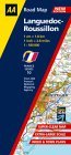
Languedoc-Roussillon
(AA Road Map France S.)
This fully updated series of sheet maps with top quality mapping from both the AA and IGN (France's national mapping agency) are all you need for motoring in France.
The maps combine clear design and more road detail with an easy to read scale to ensure that you never lose your way.
Around four town plans per sheet map accompany a comprehensive place-name index.
New for these editions, RADAR speed cameras are shown.
There are also easy to follow toll-free motorways and dual carriageways as well as tourist symbols, airports, and leisure parks.
The maps are folded to a handy slim line format and are contained in a durable encapsulated card cover.

Languedoc-Roussillon
Michelin Travel Publications
Covering the Languedoc/Roussillon area at a scale of 1:200,000, this is one of the Michelin "Regional Maps", with updated information for motorists.
Scenic routes are indicated by green borders along the lines of the roads.
France Map
GeoCenter International Ltd

.
Languedoc Roussillon
AA Maps and Atlases;
Sheet map offerng clear, modern mapping from the AA and the Institut Geographique National, France's National Mapping Agency.
Features include: town plans; information on toll gates, service areas, road numbers, tunnels and passes; details of road classifications; a place name index; departments and national boundaries; and airports and places of interest.

Michelin Aude, Pyrenees-Orientales
Michelin Travel Publications

Detailing the Aude / Pyrenees-Orientales departements of France.
Laminated fold-out map includes a complete index of place names and covers all regional specialities, heritage and traditions.
Offers clear and concise mapping for stress-free travelling.
Michelin Map No. 344
Luchon Andorre Carcassonne Perpignan
Aude Pyrenees-Orientales (France)
Michelin Travel Publications
Scale 1:150,000 (1 cm. = 1.5 km.)
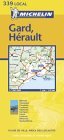
Michelin Map No. 339
Gard, Herault Pyrenees-Orientales (France)
Michelin Travel Publications
Scale 1:150,000 (1 cm. = 1.5 km.)
Michalin Map Number 330:
Cantal Lozere Dijon Macon (France)
Michelin Travel Publications
Surrounding Area Scale 1:175000